Native Americans thrive on America’s biggest Indian reserve. This enormous area has everything from undulating hills to deserts.
The reservation preserves Native American culture. Families speak their original tongues, perform ancestral rites, and celebrate traditional festivals. Their spirituality and livelihoods depend on the land.
The reserve is modern despite its size and seclusion. Tourism, energy, and other industries thrive there. Many inhabitants work in the tribal administration, schools, or small enterprises.
Despite these improvements, the reserve faces several obstacles. Many citizens are poor and unemployed, and education, healthcare, and other critical services are scarce. Drug and alcohol misuse and crime have plagued the town.
This reservation’s Native American population is resilient despite these hardships. They have battled hard to preserve their land, language, and culture and construct a brighter future for their children. Residents of the biggest US Indian reserve are proud, resilient, and hopeful today.
The biggest Indian reserve reminds the country of its colonialism and oppression of Indigenous peoples. It is where old traditions and contemporary life coexist, and a better future is always possible. With this, let’s see the 8 largest Indian reservations.
-
Tohono O’odham Nation Reservation
Population Density: 1.72 per square mile
Total Area: 4,340.98 square miles
Year Established: 1917
 Source: Wikimedia
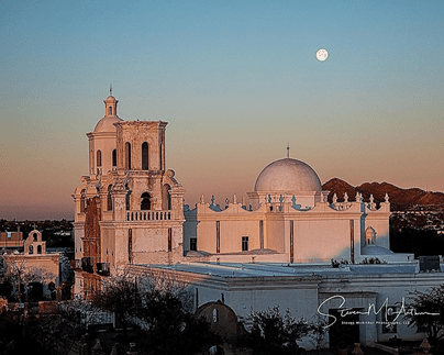
The Tohono O’odham Indian Reservation is a Native American reservation held by the Tohono O’odham Nation and is located in Arizona in the United States. According to the census completed in the year 2000, the total population of the reserve was 10,787.
The land area of the reservation is 4,340.98 square miles, which is equivalent to 97.48 percent of the entire land area of the Tohono O’odham Nation. A section of the center of Pima County, southern Pinal County, and southeast Maricopa County are included within the reserve.
The area also contains the Quinlan and Baboquivari Mountains, home to Kitt Peak, the Kitt Peak National Observatory, and several telescopes. Moreover, Baboquivari Peak can be found on this territory.
Did You Know?
The Tohono O’odham Nation has granted the Tohono Astronomical Society a lease on these astronomy locations. In the 1950s, the council approved the lease, which called for a one-time payment of US$25,000 and $10 per acre yearly.
-
Osage Reservation
Population Density: 4.31 per square mile
Total Area: 2,304 square miles
Year Established: 1872
 Source: Wikimedia
The Osage Nation is a Great Plains Native American tribe in the central United States. During the same time, around 700 BC, additional tribes that belonged to the same language family emerged in the river basins of the Ohio and Mississippi rivers.
As a consequence of the Iroquois moving into the Ohio Valley to pursue fresh hunting grounds, they moved westward in the 17th century. They settled close to the junction of the Missouri and Mississippi rivers. This occurred after the Iroquois had invaded the Ohio Valley.
By the beginning of the 19th century, the Osage had risen to preeminent authority in the area, inspiring terror among the surrounding tribes. Nomadic agriculture and buffalo hunting were their primary sources of income.
Did You Know?
The name of this Native American tribe, which comes from the French and means “calm water,” was eventually anglicized as “Osage.”
-
Gila River Indian Reservation
Population Density: 19.27 per square mile
Total Area: 583.7 square miles
Year Established: 1859
 Source: Wikimedia
The Gila River Indian Community is an American Indian reservation that can be found in the state of Arizona in the United States. It is located on the south side of the city of Phoenix, in Pinal and Maricopa counties, and is included in the Phoenix Metropolitan Area.
In 1859, the Gila River Indian Reservation was formed, and in 1939, the Congress of the United States legally established the Gila River Indian Community. The Akimel O’odham and the Pee-Posh tribes have made this hamlet their home at one time or another.
Along the Gila River, it is divided into seven districts, and the settlements of Sacaton, Komatke, Santan, and Blackwater make up its most populous areas. Sacaton is the location of the majority of the administrative offices and departments of the tribe.
Did You Know?
The Community produces a monthly newspaper and operates its own telecom firm, energy utility, industrial park, and healthcare facility.
-
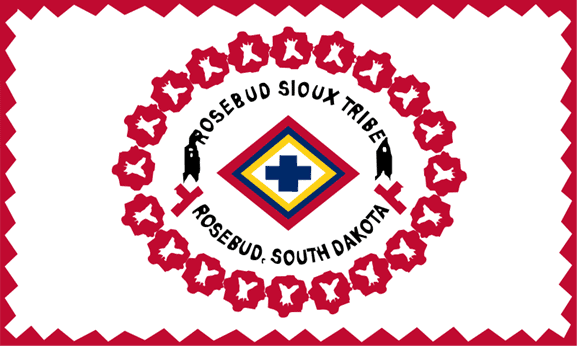
Rosebud Indian Reservation
Population Density: 5.8 per square mile
Total Area: 1,970.36 square miles
Year Established: 1889
 Source: Wikimedia
The United States state of South Dakota has an Indian reserve known as the Rosebud Indian Reservation. The Rosebud Sioux Tribe, a Sicangu tribe of Lakota people recognized by the federal government, calls this place their homeland.
After the Great Sioux Reservation, formed by the Treaty of Fort Laramie, the United States of America established the Rosebud Indian Reservation in 1889. This followed the partitioning of the Great Sioux Reservation (1868).
The Great Sioux Reservation included the West River, South Dakota (the region located west of the Missouri River), and a portion of northern Nebraska and eastern Montana.
Did You Know?
The Brulé Sioux are also known by their Lakota name, Sicangu Oyate, which translates to “Burnt Thigh Nation.” Their French name also knows as the Brulé Sioux.
-
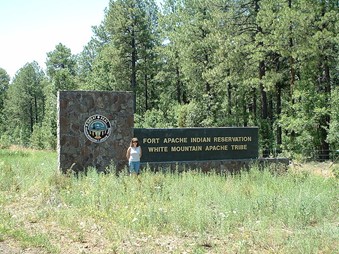
Fort Apache Reservation
Population Density: 4.65 per square mile
Total Area: 2,631 square miles
Year Established: 1891
 Source: Wikimedia
The Fort Apache Reservation is a Native American reservation that spans portions of three different counties in the United States: Navajo, Gila, and Apache. It is located on the border of New Mexico and Arizona. The tribe has federal recognition.
The White Mountain Apache and all other Apache peoples collectively referred to by the colonial categorization word Apache. Three primary groups made up the White Mountain Apache.
These big groups were composed of smaller sub-groups known as bands and clans, and within these larger groupings were families.
-
San Carlos Reservation
Population Density: 5.67 per square mile
Total Area: 2,867.18 square miles
Year Established: 1871
 Source: Wikimedia
The Chiricahua Apache tribe and surrounding Yavapai and Apache bands were physically ejected from their original homelands and relocated to the San Carlos Indian Reservation in southeastern Arizona, United States, in 1872.
This was done in accordance with a plan conceived by General George Crook to pit the various Apache tribes against one another. The Chiricahua Apache tribe was the initial occupant of the area.
The government delegated responsibility for administrating the newly created reservations to various religious organizations, and the Dutch Reformed Church was given authority for the San Carlos Apache American Reservation.
Did You Know?
The San Carlos Apache Reservation was formally designated as such by President Ulysses S. Grant on December 14, 1872.
-
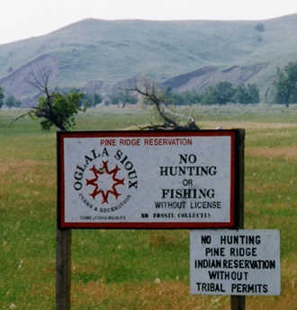
Pine Ridge Reservation
Population Density: 5.7 per square mile
Total Area: 3,468.86 square miles
Year Established: 1889
 Source: Wikimedia
Pine Ridge Indian Reservation is an Oglala Lakota Indian reservation that is situated almost completely within the state of South Dakota in the United States of America, with a tiny segment located in the state of Nebraska.
A portion of the mixed grass prairie, an ecological transition zone between the short and tall grass prairie, comprises the reserve. The mixed-grass prairie, the short-grass prairie, and the tall-grass prairie are all a component of the Great Plains.
In the reserve and the surrounding area, there is a rich and diverse population of plant and animal life, including the critically endangered black-footed ferret.
Did You Know?
The reservation’s official name in Lakota is Waz Aháha Oyáke. It is also known as Pine Ridge Agency. Formerly included within the area of the Great Sioux Reservation, Pine Ridge was founded by the Act of March 2, 1889.
-
Navajo Nation
Population Density: 6 per square mile
Total Area: 27,413 square miles
Year Established: 1868
 Source: Wikimedia
The Navajo Nation is the largest Indian reservation. The United States of America is home to a Native American reserve known as the Navajo Nation. It is located in the northeastern part of Arizona, the northwestern part of New Mexico, and the southeast corner of Utah.
After gaining control in the Mexican-American War, the United States finally took full possession of this area in 1848.
When Arizona and New Mexico were admitted as states into the union in 1912, the reservation was located inside New Mexico Territory and straddled what later became the boundary between the two states.
Did You Know?
In contrast to most reservations, it has seen many expansions since its founding in 1868. It now encompasses the majority of northeastern Arizona, a sizeable piece of northern New Mexico, and most of the territory south of the San Juan River in southeast Utah.
RELATED READINGS
10 Largest Native Tribes in America
9 Largest Empires in the World
7 Oldest African Tribes
10 Oldest Indigenous Groups in the Americas
10 Oldest Civilizations in the World (Updated 2021)