Some of the world’s biggest rivers are in the US. These rivers impact the country’s economy, environment, and history. They provide irrigation, hydroelectric dam electricity, and commodities and people transit. In addition, they are recreational regions with varied plant and animal life.
One northern river starts in a tiny lake and runs hundreds of kilometers before spilling into a vast estuary. It supplies water and electricity to millions across various states. Another western river has strong currents and a beautiful landscape. It flows between valleys and mountains, providing stunning views.
Further south, a river with a rich history begins in a state with varied terrain and travels through many states before emptying into a vast delta. This river developed the nation and is now a major transportation route.
Finally, a river in the east is large and twisting. Its vegetation and animal life include numerous rare fish species.
These rivers and many others in the US provide crucial resources, leisure, and homes for various plant and animal species, making them a significant component of the country’s natural history. Now, it’s time to know the 8 largest rivers in the US.
-
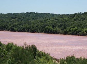
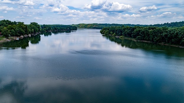
Red River
Watershed Area: 65,590 square miles
Water Discharge: 30,100 cubic feet per second
States & Provinces: Oklahoma, Texas, Arkansas
 Source: Wikimedia
The Red River, often known as the Red River of the South, is one of the most significant rivers that runs through the southern region of the United States. It got its name from the reddish tint of its water, caused by its watershed traveling through red-bed terrain.
This river is one of many that have the same name. Although it was a tributary of the Mississippi River in the past, the Red River is currently a tributary of the Atchafalaya River.
The Atchafalaya River is a distributary of the Mississippi River that flows into the Gulf of Mexico independently from the Mississippi.
As it flows through its tributaries and into Lake Texoma, the Red River becomes more saline. A natural process that has been around since ancient times is responsible for the saltiness of the water.
Did You Know?
Approximately 250 million years ago, the Red River covered most of what are today the states of Ohio, Indiana, and Illinois.
-
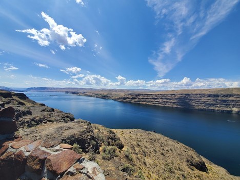
Columbia River
Watershed Area: 65,590 square miles
Water Discharge: 30,100 cubic feet per second
States & Provinces: British Columbia, Washington, Oregon
 Source: Unsplash
The watershed of the Columbia River extends over a significant region of North America, encompassing portions of seven states as well as the Canadian province of British Columbia.
The river has 1,200 miles and travels through four mountain ranges on its way to the ocean. It also carries more water to the Pacific Ocean than any other river in either North or South America.
In the western part of the United States, the watershed serves as a key background for urban growth, agricultural expansion, transportation, recreational opportunities, fisheries, and hydroelectric power.
Did You Know?
The river supplies potable water to several villages along its path and irrigates 600,000 acres of agricultural land.
-
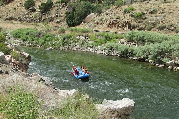
Arkansas River
Watershed Area: 160,200 square miles
Water Discharge: 35,500 cubic feet per second
States & Provinces: Colorado, Kansas, Oklahoma
 Source: Wikimedia
The headwaters of the Arkansas River are located high in the Sawatch Range of the Rocky Mountains, close to Leadville, Colorado. The river flows down to the Mississippi River before emptying into the Arkansas River Delta.
The accounts of the Coronado Expedition, which took place between 1540 and 1541, include the oldest record of this river. In those reports, the river was referred to as “St. Peter’s and St. Paul’s River,” and it was given that name.
It is the second-longest tributary in the Mississippi–Missouri system and the 45th-largest river in the world, with a total length of 1,469 miles (2,364 kilometers). The Missouri River is the sixth-longest river in the United States.
Did You Know?
The discovery of placer gold in the Leadville region in 1859 attracted many people hoping to become wealthy. Still, the readily recoverable placer gold was rapidly depleted.
-
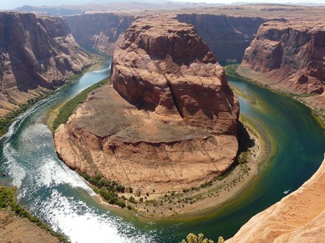
Colorado River
Watershed Area: 248,000 square miles
Water Discharge: 1,400 cubic feet per second
States & Provinces: Colorado, Utah, Arizona
 Source: Pexels
The Colorado River, formerly known as the Grand, starts on the Continental Divide in Colorado’s Rocky Mountain National Park. It begins as a cold mountain trout stream. Still, throughout its upper leg of a 1,450-mile journey, it transforms into a classic Western waterway that cuts through jagged gorges and flows between expansive pastoral ranchlands.
In the 1920s, western states started constructing dams to redirect water flow from the Colorado River to areas such as Los Angeles, San Diego, Phoenix, and others experiencing rapid urbanization. This was done to divvy up the river’s water supply.
It is estimated that as much as 70 percent of the river’s water is now being diverted to irrigate agriculture over 3.5 million acres in the United States, Mexico, and seven states in the United States.
Did You Know?
According to geoscientist Brad Udall, director of the University of Colorado Western Water Assessment, the effects of climate change are anticipated to reduce the river’s flow by between 5 and 20 percent in the next 40 years.
-
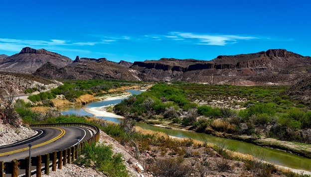
Rio Grande
Watershed Area: 340,000 square miles
Water Discharge: 1,300 cubic feet per second
States & Provinces: Colorado, New Mexico, Texas
 Source: Pixabay
The Rio Grande is a transnational river serving as a water source and life for about 6 million people. It flows through two countries and several different Pueblos. According to the World Wildlife Fund, while facing persistent risk, the river maintains its position as one of the world’s top 10 most endangered rivers.
Its source is in the San Juan Mountains of Colorado, which are situated in the southern Rockies. More specifically, its origins may be discovered on the Continental Divide near Stony Pass, about 12,588 feet above sea level.
After that, the river starts its lengthy trip, which will take it through a varied terrain that includes verdant national forests and arid regions until it reaches its ultimate goal and exit at the Gulf of Mexico.
Did You Know?
Fresh water and the delicate estuary waters of the shore converge in Boca Chica, on the border of Texas and Mexico. This is where the Rio Grande and Rio Bravo rivers meet.
-
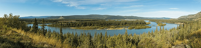
Yukon River
Watershed Area: 324,000 square miles
Water Discharge: 224,000 cubic feet per second
States & Provinces: British Columbia, Yukon Territory, Alaska
 Source: Wikimedia
The Yukon River is a significant waterway located in the far western region of North America. It is the third-longest river that flows through the United States. Some anthropologists think the Yukon Valley was the primary migratory route used by the first people to settle in North America.
The glacier known as Llewellyn, located near the southernmost tip of Atlin Lake in the province of British Columbia in Canada, is the source of the Yukon River.
Coniferous woods may be found covering both the valley bottoms and the lower mountainsides throughout the Yukon River Basin.
Did You Know?
During the height of the Klondike Gold Rush, one of the most important modes of transportation was the Yukon River. However, the Klondike Highway wasn’t finished being built until the 1950s. Thus, paddle-wheel riverboats continued to navigate the river until then.
-
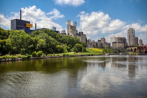
Mississippi River
Watershed Area: 1,260,000 square miles
Water Discharge: 650,000 cubic feet per second
States & Provinces: Minnesota, Wisconsin, Iowa
 Source: Pexels
The Mississippi River is one of the world’s main river systems because of its size, the variety of habitats it contains, and the amount of life it supports.
Native Americans built their homes along the river’s banks and relied on it as a source of food and transportation. As a result, the first European explorers utilized the Mississippi River to access the interior and northern parts of the land that would later become the United States of America.
The spring season is often when the river has its highest flow since this is the time of year when the basins of the river’s tributaries, most notably the Missouri and Ohio, are filled with water due to heavy rainfall and melting snow. Because of this increase in flow, the river regularly breaches its banks and levees, which then causes it to flood the floodplain that lies close to it.
Did You Know?
In addition to being one of the most significant commercial rivers in the world, it is also one of the most important migratory routes in North America for both fish and birds.
-
Missouri River
Watershed Area: 529,353 square miles
Water Discharge: 69,100 cubic feet per second
States & Provinces: Montana, North Dakota, South Dakota
 Source: Pixabay
With more than 2,500 miles from its source on the eastern side of the Rockies near Three Forks, Montana, to its confluence with the Mississippi River at St. Louis, Missouri, the Missouri River is the largest river in the United States.
Congress added the Upper Missouri River’s 149 miles to the National Wild and Scenic River System in 1976, which referred to it as an invaluable heritage of the old American west.
People have relied on the Missouri River and its tributaries as a source of food and transportation for over 12,000 years.
Did You Know?
The public lands of the Upper Missouri River Breaks National Monument, managed by the federal and state governments, significantly influence the surrounding area’s way of life and economy.
RELATED READINGS
10 Longest Rivers in the World
10 Largest Lakes in the World
8 Largest Manmade Lakes In The U.S.
7 Largest Waterfalls in the World
7 Oldest Rivers in the World